Dependable outpost for road-trippers at the base of the ancient Karatau ridges –
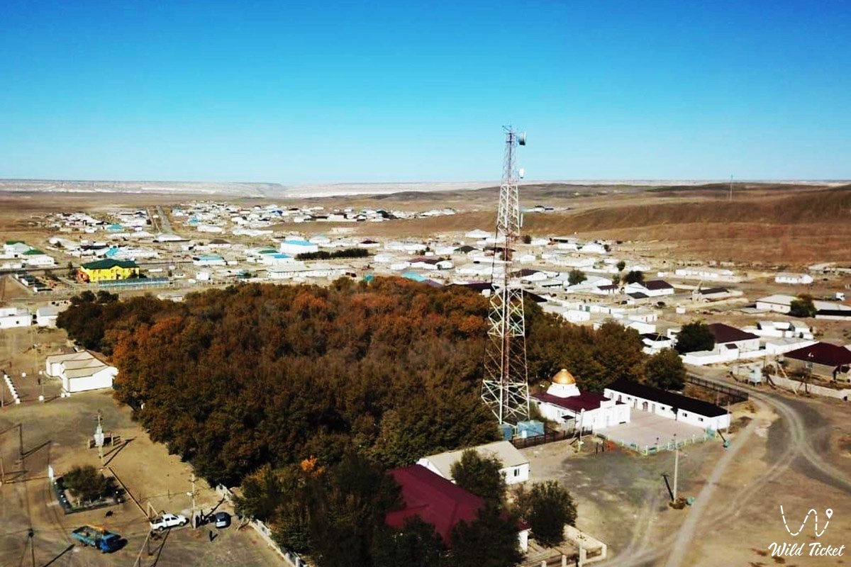
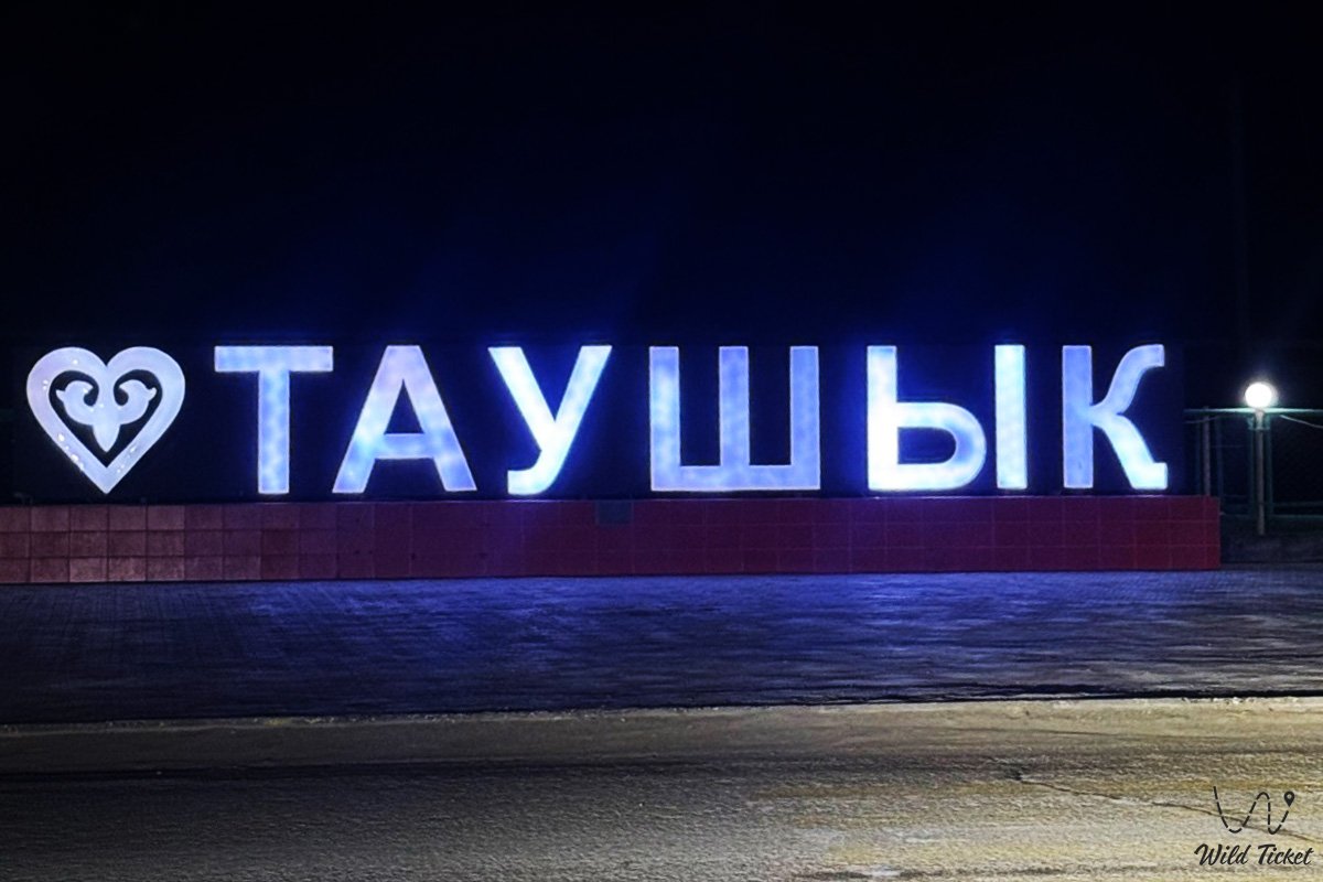
Tauchik Village (Kaz. Taushyq) represents an ancient and strategically vital rural settlement in western Kazakhstan. This large steppe locality is situated in the eastern sector of the Tupkaragan district, spread across flat elevations at the northern foot of the Western Karatau ridge.
This entire settled area serves as an essential logistics and transport crossroad of the Mangystau region, connecting the regional administrative center with the northern coast and the oilfields of Buzachi via modern paved highways. Approximately 40 kilometers to the north stretch the shallow waters of Sarytas and Koshak bays, where the boundless Caspian Sea rolls its waves, shaping the climate and heritage of the entire region.
In the tourism and expedition logistics of Northern Mangystau, Tauchik Village functions as the premier staging base and the final major haven of civilization before setting out onto rugged off-road tracks. Just 95–100 kilometers to the south along a direct paved motorway lies the regional center Aktau, from where expedition convoys depart via the suburban village of Akshukur.
From Tauchik, packed graders and steppe tracks lead to the foremost treasures of the territory: the grandiose Shakpaktysay Canyon with the underground Shakpak-Ata mosque, the chalk gorge of Kapamsay featuring a mulberry grove within a cavernous grotto, the ancient rock sanctuary of Sultan-Epe, the Kenty-Baba necropolis, the weeping cliffs of Tamshaly, the freshwater lake of Saura Canyon, and the Zhygylgan sinkhole.
The geological foundation of the surroundings is composed of coal-bearing and sandstone strata from the Jurassic, Cretaceous, and Paleogene periods, deposited on the floor of the vanished prehistoric Tethys Ocean. From Tauchik, steppe roads run east and southeast into the interior of the Mangyshlak Peninsula: toward the sacred height of Mount Otpan-Tau with the Aday-Ata complex, the spherical concretions of the Torysh Valley, solitary residual Mount Sherkala, the colorful Jurassic clays of the Kokala tract, and the narrow slate defile of Karadayirmen Gorge.
The paramount historical legacy of the settlement is its industrial wartime service: during the Great Patriotic War, the renowned coal mines of Tauchik operated here, supplying fuel to railway locomotives and ships of the Caspian Military Flotilla. After replenishing water, fuel, and provisions in Tauchik, overland groups head southeast toward the snow-white chinks of the Bozzhira tract, the glistening Tuzbair salt flat, banded Mount Bokty, the Karynzharyk depression, and the strictly protected grounds of the Ustyurt State Nature Reserve.
Today, Tauchik Village is recognized as an indispensable transport and service outpost for all explorers of the Tupkaragan Peninsula. Road travelers, local historians, and pilgrims stop here, valuing the hospitality of local residents, reliable filling stations, satisfying national cuisine, and the opportunity to thoroughly prep vehicles before launching into the wild expanses of Mangystau.
--------------------------------------------
How to get there and visit –
Tauchik Village (Taushyq) is situated in the eastern sector of the Tupkaragan district, at the crossroads of key motor arteries on the Tupkaragan Peninsula. The distance from the city of Aktau is about 95–100 km to the north, from the district center town of Fort-Shevchenko – roughly 130 km to the east, from the railway station of Shetpe – around 85 km, and to the shore of Sarytas Bay – approximately 35 km.
GPS geographical coordinates of Tauchik Village:
44°20'27"N 51°20'58"E
The road route from Aktau runs north along an excellent paved highway of republican significance through the suburban settlements of Akshukur and Sayyn Shapagatov. The road traverses a level plateau with high-quality asphalt, allowing any type of motor vehicle (including standard sedans and intercity buses) to reach the settlement in just 1 hour and 15 minutes. Regular suburban bus lines and shared route taxis also connect Aktau and Tauchik.
Road network and steppe tracks: from Tauchik, the paved road extends northeast toward the oilfields of the Buzachi Peninsula (Karazhanbas and Kalamkas) and west toward Fort-Shevchenko. All side tracks leading from Tauchik toward the canyons of Kapamsay, Shakpaktysay, Sultan-Epe, and the coast of Sarytas Bay consist of unpaved gravel and dirt steppe trails.
For journeys along these radial itineraries, a prepared four-wheel-drive vehicle (4x4) with elevated clearance is strongly recommended, especially in spring and autumn when rains transform clay depressions into heavy mud.
Infrastructure and services: Tauchik is the primary supply hub in the northern peninsula. Available in the village:
– Network and private fuel stations offering AI-92, AI-95 gasoline, and diesel fuel;
– Tire repair workshops and basic automotive service points capable of patching off-road punctures;
– Grocery supermarkets, general stores, and pharmacies;
– Roadside cafes serving hearty Kazakh national dishes (beshbarmak, kuyrdak, sorpa), where boiling and fresh water can be replenished;
– A rural clinic and emergency medical station;
– Bank branches, ATMs, and postal services.
Connectivity and internet: all mobile carriers in Kazakhstan operate steadily within Tauchik and across a 10–15 km radius around it, providing dependable 4G coverage. This is the last point with reliable internet before descending into canyons or proceeding toward wild Caspian beaches.
Safety guidelines for road travelers: when departing Tauchik for northern routes, make sure to top off fuel tanks and fill spare jerrycans. Carry potable water calculated at no less than 5 liters per person per day, check pressure in spare wheels, and ensure a functional air compressor is on board.
The best season to visit is the dry shoulder period: spring from late April to early June and early autumn from September through October. During these months, oppressive heat is absent, temperatures measure a comfortable +20...+26 °C, and unpaved roads remain dry and solid. In July and August, temperatures in Tauchik can reach +40 °C, while winters are marked by biting, gale-force winds with temperatures dipping to -10...-15 °C.
--------------------------------------------
History
The history of Tauchik Village is a chronicle of industrial resilience, geological exploration, and ancient nomadic heritage on Tupkaragan.
The name "Taushyq" in Kazakh toponymy originates from combining the word "tau" (mountain) with the diminutive suffix "shyq", translating literally as "Small Mountain", "Little Hill", or "Settlement by the Knolls". This designation refers to the locality's position beside the low knolls and residual ridges of the Karatau range.
Since antiquity, the Tauchik tract served as winter quarters (kystau) for Kazakh clans of the Junior Zhuz, particularly the Aday. Ancient caravan tracks converged here, connecting the roadsteads of Tupkaragan with mainland trails leading toward the Ustyurt Plateau and the Emba River. In sandy lenses at the foot of the hills, nomads excavated deep wells (shynyrau) providing fresh water for thousands of sheep, camels, and horses.
A new industrial chapter opened in the first half of the 20th century. In the late 1930s, Soviet geologists identified commercial deposits of brown and bituminous coal within Jurassic beds around Tauchik.
Tauchik's defining epoch arrived during the harsh years of the Great Patriotic War (1941–1945). When fascist forces occupied the Donbas and cut traditional fuel supplies to the Caspian, Tauchik's mines became a vital strategic fuel source for the country. Within months, a mining settlement was erected in the open steppe, shafts were sunk, and adits were driven.
Extracted coal was hauled round the clock to the coast at Fort-Shevchenko and Bautino, where barges carried it onward to Guryev (Atyrau), Astrakhan, Baku, and Krasnovodsk. Tauchik coal fired the boilers of frontline locomotives, desalination works, and warships of the Caspian Military Flotilla, contributing significantly to victory in the battles for the Caucasus and Stalingrad. Hundreds of women, elderly workers, and evacuated specialists laboured in the shafts.
Following the war, in the 1950s and 1960s, the discovery of massive oil and gas fields across Mangystau rendered small-scale coal mining in Tauchik unprofitable, and the mines were mothballed. The settlement transitioned into an agricultural, pastoral, and logistics center. In the post-Soviet period, a modern highway was routed through Tauchik, establishing the locality as a vital transport junction for the region.
Information
Geographically and geomorphologically, Tauchik Village is situated on the boundary between the Tupkaragan Plateau and the northern slopes of the Western Karatau mountain system. The settlement occupies a gentle steppe basin at absolute elevations of +80...+110 meters above sea level. The terrain around the locality is undulating, featuring clay plains, gravelly knolls, and shallow dry gullies.
The geological structure of the area is composed of a complex sedimentary sequence. Subsurface strata include sandstones, shales, carbonaceous mudstones, and beds of Jurassic brown coal, overlain by chalk sequences and Neogene coquina limestones of the prehistoric Tethys Ocean. Preserved ventilation shafts, waste rock spoil tips, and exploratory pits from the old coal mines remain visible east of the settlement.
The hydrological regime of the area is arid. Permanent rivers and natural lakes do not exist in the vicinity. Potable water is supplied via deep aquifers and a centralized regional pipeline. Sandy tracts to the north and west hold slightly mineralized groundwater lenses that feed springs within nearby canyons.
Soil cover is characterized by zonal gray-brown desert gravelly soils with solonetz inclusions and salt-flat patches within enclosed endorheic hollows.
The climate is sharply continental, semi-desert. Summers are dry, long, and hot, with average July temperatures of +27...+30 °C (daytime sun temperatures exceeding +42 °C). Winters are moderately cold and thin on snow, yet swept by bitter winds, averaging -4...-8 °C in January. Annual precipitation is sparse at roughly 140–160 mm.
Detailed description of the venue
The infrastructural and natural ensemble of Tauchik Village encompasses the following key elements, landmarks, and operational zones:
• Central junction and service cluster – the primary road crossing featuring modern filling stations, grocery stores, tire workshops, and roadside cafes.
• Memorial of Tauchik mining heritage – a commemorative monument and historic displays honoring the miners and home-front laborers of the Great Patriotic War.
• Historic coal mine adits and spoil heaps – preserved industrial sites from the 1940s east of the village, presenting notable interest for industrial historians.
• Tauchik rural mosque – the spiritual hub of the community, constructed in the traditional Islamic architectural style with a slender minaret.
• Panoramic knolls of Tauchik – low stony hills along the southern perimeter offering sweeping vistas across the steppe and the spurs of Karatau.
• Northern expedition route fork – the road junction at the village exit where unpaved tracks diverge toward Shakpaktysay, Kapamsay, and Cape Tyub-Karagan.
Flora and fauna
Vegetation surrounding Tauchik is typical of arid wormwood-saltwort deserts and stony foothills of Mangyshlak. The plains are dominated by gray-soil wormwood, white wormwood, Anabasis salsa (biyurgun), boyalych, itsigek (Anabasis aphylla), and camelthorn (dzhantak). Along dry washes and low depressions grow thickets of tamarisk and dwarf elm. In spring, the steppe briefly blooms: ephemerals, wild steppe tulips, irises, and desert feather grasses mantle the soil in a green carpet.
Fauna of the environs comprises hardy semi-desert species. Rodents abound across the steppe: gerbils, jerboas, and sousliks. Carnivores include the corsac fox, steppe polecat, badger, and wolf. Flocks of sheep, herds of Bactrian camels, and bands of Aday horses graze across surrounding rangelands year-round. Remote rocky ravines of the Karatau range harbor Ustyurt mountain sheep (mouflons), protected under the Red Data Book of Kazakhstan.
Avifauna includes steppe species: calandra and crested larks, isabelline wheatears, sandgrouse, hoopoes, and Pallas's sandgrouse. Birds of prey nesting on power line pylons and isolated rock crags include the long-legged buzzard, lesser kestrel, steppe eagle, and saker falcon.
Herpetofauna is represented by the rapid fringe-toed lizard, steppe agama, toad-headed agama, arrow snake, dione snake, and Central Asian tortoise.
Legend
An ancient Kazakh legend concerning the Black Stone of Life and Clan Unity is preserved in Tauchik.
Tradition tells that in ages past, an exceptionally brutal winter with icy blizzards struck the Mangyshlak plateau, placing nomadic clans on the brink of disaster. The cold was so severe that birds froze in flight, while meager reserves of camelthorn and saxaul quickly ran out. Families and herds froze in their yurts, praying to Heaven for deliverance.
A wise elder gathered the warriors at the base of the small Tauchik knoll and said: "Our land is harsh above, yet generous beneath. Below these hills rests the warmth of an ancient fiery ocean." He pointed to a steep gully where seams of a curious black stone protruded through the snow.
The people excavated the stone and cast it onto the dying embers of the hearth. To their astonishment, the black stone ignited with a hot, steady, and lasting flame. It kept the yurts warm for days and nights, saving children and elders from freezing.
In gratitude, the people raised a stone cairn atop the knoll and proclaimed Tauchik a blessed sanctuary. Since then, belief holds that the earth of Tauchik preserves enduring warmth for every traveler of goodwill, and that its inhabitants are blessed with generous hearts, ready to aid anyone caught in the harshness of the steppe.
Conclusion
Tauchik Village is the operational heart and primary crossroads of Tupkaragan, where the industrial achievements of wartime years unite with the traditions of steppe hospitality and dependable services for overland explorers. A stop in Tauchik provides confidence before venturing into wild canyons, offering the opportunity to learn about Mangyshlak's mining heritage and enjoy the comfort of a steppe settlement before encountering the open expanses of the Caspian.
Interesting sights nearby:
• Shakpaktysay (Shakpak-Ata) Canyon;
• Shakpak-Ata Underground Mosque;
• Kapamsay Canyon;
• Sarytas Bay;
• Sultan-Epe Complex;
• Kenty-Baba Necropolis;
• Zhygylgan Sinkhole;
• Tamshaly Gorge;
• Saura Canyon;
• Otpan-Tau Complex;
• Torysh Valley of Stone Balls;
• Mount Sherkala;
• Kokala Tract;
• Kokbulaksay Chalk Canyon.
Sacred sights and pilgrimage destinations:
• Khanga-Baba Necropolis;
• Karaman-Ata Mosque;
• Sisem-Ata Necropolis;
• Shopan-Ata Mosque;
• Beket-Ata Mosque in Oglandy;
• Yerzhan Khazret Mausoleum;
• Karagas-Ata Necropolis;
• Koshkar-Ata Necropolis;
• Ushkan-Ata Necropolis.
Photogallery: